How to Use The 1839 Tithe Allocation Map
This Google Map has two types of information.
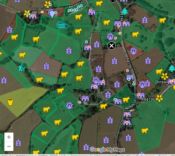
The tinted polygons indicate the fields, ponds and woodland as listed on the Tithe Allocation map by Standidge & Co. in 1839 for the Tithe Commissioners.
Click on one of these polygons and you should see a window with the name of the item you clicked on.
Click on one of the other icons; (yellow cows - for meadows/leasowe, purple leaf/corn - for arable, yellow beer glass - for hop fields, purple tree - for orchards, purple buildings - for buildings, yellow flower - for gardens, green trees - for coppice or other woodland) and you should see a window with the full tithe register entry for that item.
If you are viewing on a mobile device or Smartphone, you can, if you prefer, view the link directly on Google Maps here.
On Android phones tapping an icon may just give you the tithe number; tap on that and you will see the full tithe entry.