As the majority of maps are copyrighted we are unable to print them here but we can provide links to these maps. We intend to add to this list in the near future.
Shrawley Development Boundaries
|
Shrawley Footpaths
To see the map of the footpaths in Shrawley (Public Rights of Way)
Click on the link below
Click on Menu
Click on Search (top right of Table of Contents)
Scroll down to Place - 'Select location', click and select Shrawley
This shows the Ordinance Survey map of Shrawley. To see the Aerial photographs
Click on Maps (in box on left hand side of the screen)
Select Aerial photographs
History of Shrawley Footpaths
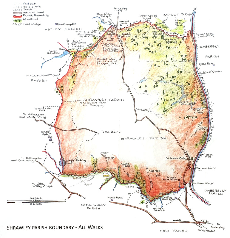
Shrawley Parish Boundary
This map is printed with the kind permission of Jane Field who has written a book on walking the Shrawley Parish Boundary. Please note that the permitted Shrawley footpaths do not follow the Parish Boundary and the walks referred to could only be made after she had obtained permission from the land owners.
To read the book please click on link below
SSSI (Site of Special Scientific Interest) in Shrawley
A Site of Scientific Interest(SSSI) describes an area that is of particular interest to science due to the rare species of flora or fauna it contains. Most of Shrawley Wood is an SSSI site as it has the largest collection of small leaf lime trees in the UK.
To see a map of the SSSI area
Click on the link below
Scroll down to Shrawley Wood
Click on the map icon on the far right of the screen.
To see a map of the SSSI area
Click on the link below
Scroll down to Shrawley Wood
Click on the map icon on the far right of the screen.
Shrawley Historical Maps available at the Hive in Worcester
The following list is a list of Shrawley Maps and Plans that are available in the History Section of the Hive in Worcester. The lists were drawn up by Valerie Powick.
- List of Shrawley Historical Maps